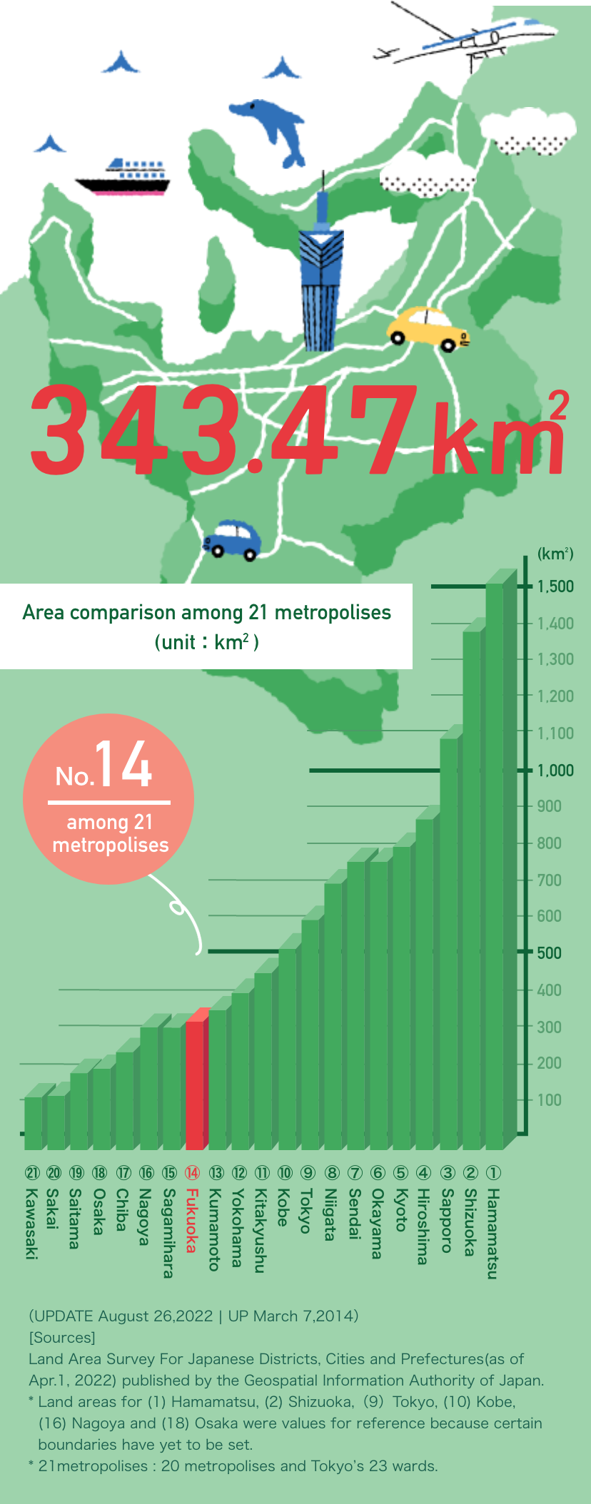

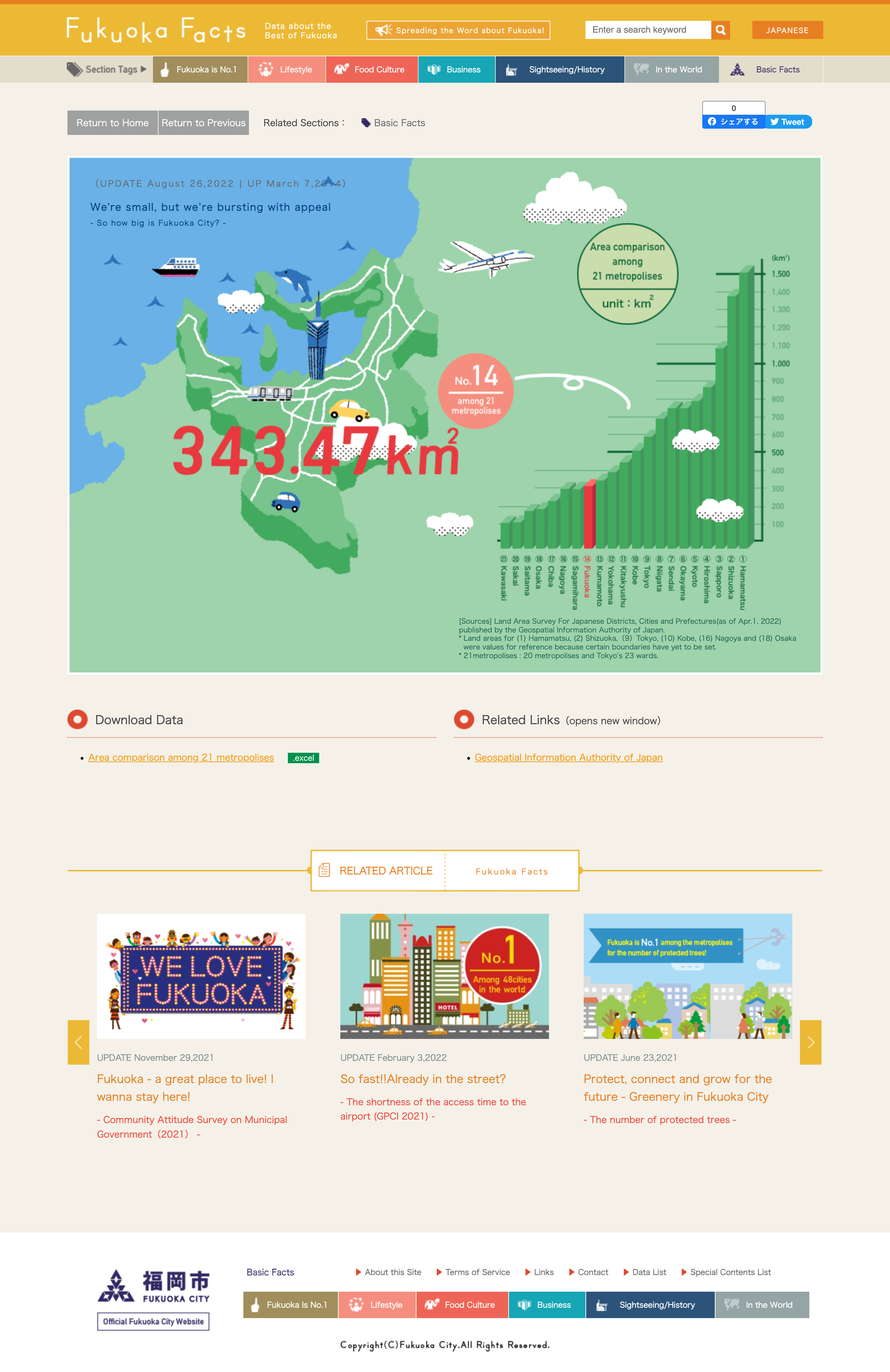
(UPDATE August 26,2022 | UP March 7,2014)


[Sources] Land Area Survey For Japanese Districts, Cities and Prefectures(as of Apr.1, 2022)
published by the Geospatial Information Authority of Japan.
* Land areas for (1) Hamamatsu, (2) Shizuoka,(9)Tokyo, (10) Kobe, (16) Nagoya and (18) Osaka
were values for reference because certain boundaries have yet to be set.
* 21metropolises : 20 metropolises and Tokyo’s 23 wards.